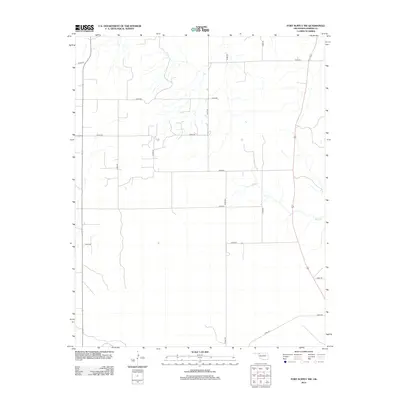
2012 Map of Fort Supply NW
USGS Topo · Published 2012About this map
The Beaver River flows along the southern edge of this Oklahoma Panhandle landscape, where the High Plains terrain is etched by drainage systems like Sand Cr. This 2012 survey documents a rural Harper County environment defined by the Public Land Survey System, where a rigid grid of gravel and section-line roads, including E0210 Rd and N1880 Rd, provides access to agricultural parcels and remote ranching outposts. The topographic detail highlights the subtle elevation changes between the river valley and the northern uplands, capturing the region's sparse settlement pattern and the critical importance of water courses in an otherwise arid prairie setting.
Find a feature on this map
16 named features on this map. Tap any name to fly to it.
Don’t see what you’re looking for? This feature index may not catch every label — zoom into the map to look around manually.
Map Details
Editions of this 2012 Fort Supply NW Map
This is the sole edition of this map. No revisions or reprints were ever made.
Other maps of this area

1955 · Woodward
USGS Topo · 1:250,000

1958 · Woodward
USGS Topo · 1:250,000

1970 · Buffalo SE
USGS Topo · 1:24,000

1970 · Buffalo
USGS Topo · 1:24,000

1971 · Rosston SE
USGS Topo · 1:24,000

1971 · May East
USGS Topo · 1:24,000

1971 · Fort Supply
USGS Topo · 1:24,000

1971 · Fort Supply NW
USGS Topo · 1:24,000

1971 · Fort Supply NE
USGS Topo · 1:24,000

1971 · Laverne NE
USGS Topo · 1:24,000