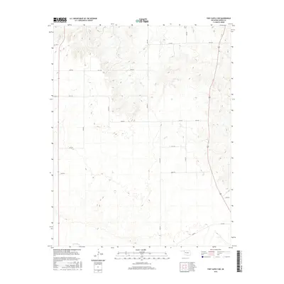
2016 Map of Fort Supply NW
USGS Topo · Published 2016About this map
Beaver River winds along the southern edge of this Oklahoma landscape, a critical water source in the High Plains of Harper County. The terrain is defined by a dense network of sectional roads, including EW 190 Rd and NS 188 Rd, which divide the region into the characteristic grid of the American West. These routes, such as D1883 Rd and EW 26 Rd, provide access to the various cattle ranches and agricultural holdings that dominate the area. The drainage of Sand Cr carves through the central portion of the map, illustrating the subtle but important topography that influences local movement and land use. This 2016 survey provides a clear view of the modern rural infrastructure and property divisions as they existed in the early 21st century.
Find a feature on this map
21 named features on this map. Tap any name to fly to it.
Don’t see what you’re looking for? This feature index may not catch every label — zoom into the map to look around manually.
Map Details
Editions of this 2016 Fort Supply NW Map
This is the sole edition of this map. No revisions or reprints were ever made.
Other maps of this area

1955 · Woodward
USGS Topo · 1:250,000

1958 · Woodward
USGS Topo · 1:250,000

1970 · Buffalo SE
USGS Topo · 1:24,000

1970 · Buffalo
USGS Topo · 1:24,000

1971 · Rosston SE
USGS Topo · 1:24,000

1971 · May East
USGS Topo · 1:24,000

1971 · Fort Supply
USGS Topo · 1:24,000

1971 · Fort Supply NW
USGS Topo · 1:24,000

1971 · Fort Supply NE
USGS Topo · 1:24,000

1971 · Laverne NE
USGS Topo · 1:24,000