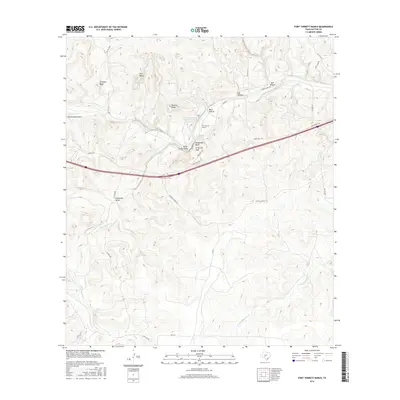
2016 Map of Fort Terrett Ranch
USGS Topo · Published 2016About this map
Fort Terrett Ranch serves as the focal point of this Sutton County landscape, situated where the North Llano River carves through the Edwards Plateau. The geography is defined by a series of prominent limestone features, including the rising heights of Ft Terrett Peak and the vertical faces of Kingfisher Bluff and Chimney Bluff. Water management is evident through the Fort Terrett Ranch River Reservoir and the Fort Terrett Spring, highlighting the critical role of reliable water sources in this semi-arid ranching country.
Find a feature on this map
33 named features on this map. Tap any name to fly to it.
Don’t see what you’re looking for? This feature index may not catch every label — zoom into the map to look around manually.
Map Details
Editions of this 2016 Fort Terrett Ranch Map
This is the sole edition of this map. No revisions or reprints were ever made.
Other maps of this area

1893 · Rock Springs
USGS Topo · 1:125,000

1893 · Fort McKavett
USGS Topo · 1:125,000

1954 · Sonora
USGS Topo · 1:250,000

1958 · Sonora
USGS Topo · 1:250,000

1962 · Hill Ranch
USGS Topo · 1:24,000

1962 · Roosevelt
USGS Topo · 1:24,000

1962 · Stewart Ranch
USGS Topo · 1:24,000
1962 · Bundy Ranch
USGS Topo · 1:24,000

1963 · Live Oak Draw
USGS Topo · 1:24,000

1963 · McKegan Draw
USGS Topo · 1:24,000