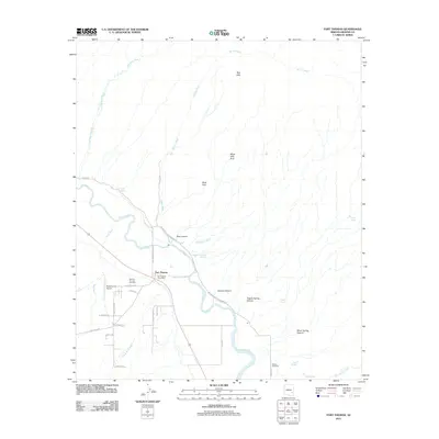
2011 Map of Fort Thomas
USGS Topo · Published 2011About this map
Fort Thomas serves as the focal point for this section of the Gila Valley, where the Gila River cuts a green path through the arid Graham County landscape. The settlement is anchored by the Fort Thomas Post Office and carries significant local history, evidenced by the Old Fort Thomas Cemetery located near the riverbank. This 2011 survey documents a rural landscape where modern roads like McEwen Ranch-Geronimo Rd and Poverty Flat Rd intersect older land patterns. The surrounding terrain is defined by dry watercourses like Day Mine Wash and Burton Wash, which drain the elevated Black Hills and the Black Hills Arch. Family and local history can be traced through landmarks such as McEuen Cemetery and Charley Thompson Springs, alongside utilitarian features like the Regeneration Airport and a network of agricultural lanes including Hog Holler Rd.
Find a feature on this map
40 named features on this map. Tap any name to fly to it.
Don’t see what you’re looking for? This feature index may not catch every label — zoom into the map to look around manually.
Map Details
Editions of this 2011 Fort Thomas Map
This is the sole edition of this map. No revisions or reprints were ever made.
Other maps of this area

1944 · Jackson Mtn.
USGS Topo · 1:62,500

1946 · Jackson Mtn.
USGS Topo · 1:62,500

1954 · Silver City
USGS Topo · 1:250,000

1954 · Clifton
USGS Topo · 1:250,000

1954 · Mesa
USGS Topo · 1:250,000

1956 · Tucson
USGS Topo · 1:250,000

1957 · Mesa
USGS Topo · 1:250,000

1957 · Clifton
USGS Topo · 1:250,000

1958 · Silver City
USGS Topo · 1:250,000

1958 · Clifton
USGS Topo · 1:250,000