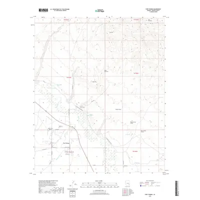
2018 Map of Fort Thomas
USGS Topo · Published 2018About this map
Fort Thomas sits in the valley of the Gila River, where the landscape is defined by a sophisticated network of desert irrigation and rugged terrain. This 2018 survey documents the vital water infrastructure of the region, including the Fort Thomas Canal and the Colvin-Jones Canal, which divert water to support local agriculture. The map preserves significant genealogical landmarks like the Old Fort Thomas Cem and the McEuen Cem, anchoring the modern settlement to its frontier origins. To the north and east, the elevation rises sharply into the Gila Mountains and the Red Hills, cut by numerous drainage features such as Day Mine Wash and Burton Wash. These geological formations create a complex topography of ridges and basins, including the distinct Black Hills Arch and the deep passage of Box Canyon. Local ranching and aviation history is noted through features like the Regeneration Airport and several named springs, such as Charley Thompson Springs and Teague Spring, which remain critical markers in this arid environment.
Find a feature on this map
45 named features on this map. Tap any name to fly to it.
Don’t see what you’re looking for? This feature index may not catch every label — zoom into the map to look around manually.
Map Details
Editions of this 2018 Fort Thomas Map
This is the sole edition of this map. No revisions or reprints were ever made.
Other maps of this area

1944 · Jackson Mtn.
USGS Topo · 1:62,500

1946 · Jackson Mtn.
USGS Topo · 1:62,500

1954 · Silver City
USGS Topo · 1:250,000

1954 · Clifton
USGS Topo · 1:250,000

1954 · Mesa
USGS Topo · 1:250,000

1956 · Tucson
USGS Topo · 1:250,000

1957 · Mesa
USGS Topo · 1:250,000

1957 · Clifton
USGS Topo · 1:250,000

1958 · Silver City
USGS Topo · 1:250,000

1958 · Clifton
USGS Topo · 1:250,000