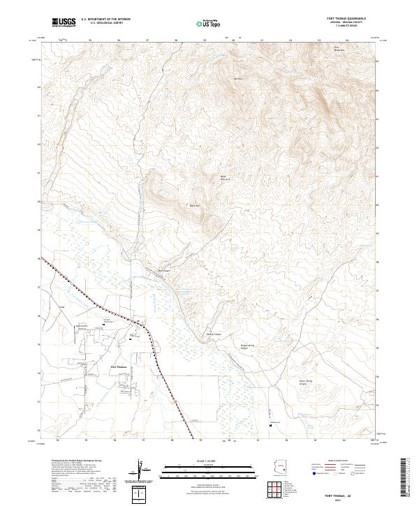
2021 Map of Fort Thomas
USGS Topo · Published 2021About this map
Fort Thomas sits along the southern bank of the Gila River, serving as a hub for local agriculture and transportation in Graham County. The irrigation network of the Colvin-Jones Canal and Fort Thomas Canal suggests a landscape shaped by water management in a semi-arid environment. To the north, the terrain rises into the Gila Mountains and Red Hills, while the Black Hills Arch and Black Hills dominate the central topography. Genealogy researchers will find significant value in the location of several burial grounds, including the Old Fort Thomas Cem, Fort Thomas Cem, and the remote McEuen Cem. Numerous family-named landmarks such as Tom Niece Spring and Charley Thompson Springs are noted throughout the washes and canyons, alongside the presence of the Regeneration Airport situated west of the main settlement.
Find a feature on this map
49 named features on this map. Tap any name to fly to it.
Don’t see what you’re looking for? This feature index may not catch every label — zoom into the map to look around manually.
Map Details
Editions of this 2021 Fort Thomas Map
This is the sole edition of this map. No revisions or reprints were ever made.
Other maps of this area

1944 · Jackson Mtn.
USGS Topo · 1:62,500

1946 · Jackson Mtn.
USGS Topo · 1:62,500

1954 · Silver City
USGS Topo · 1:250,000

1954 · Clifton
USGS Topo · 1:250,000

1954 · Mesa
USGS Topo · 1:250,000

1956 · Tucson
USGS Topo · 1:250,000

1957 · Mesa
USGS Topo · 1:250,000

1957 · Clifton
USGS Topo · 1:250,000

1958 · Silver City
USGS Topo · 1:250,000

1958 · Clifton
USGS Topo · 1:250,000