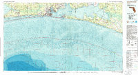
1978 Map of Fort Walton Beach
USGS Topo · Published 1986About this map
Santa Rosa Island stretches along the southern edge of this survey, shielding the Santa Rosa Sound and the extensive waters of Choctawhatchee Bay from the open Gulf of Mexico. The late 1970s landscape is defined by the massive footprint of Eglin Air Force Base, which occupies much of the interior forest and coastal inlets. The corridor of the Intracoastal Waterway links the growing coastal communities of Fort Walton Beach, Destin, and Mary Esther. Inland, the map reveals a complex network of bayous including Garnier and Boggy, which provide deep-water access for settlements like Shalimar and Valparaiso. This edition includes detailed bathymetry for the Gulf and the bay, illustrating the underwater topography near Moreno Point and the various sandbars along the coastline. Historic rail infrastructure is represented by the U S Govt RR serving the military installations, while established beach colonies like Grayton Beach and Seagrove Beach dot the eastern shoreline.
Find a feature on this map
73 named features on this map. Tap any name to fly to it.
Don’t see what you’re looking for? This feature index may not catch every label — zoom into the map to look around manually.
Map Details
Editions of this 1978 Fort Walton Beach Map
2 editions found
Other maps of this area

1920 · Milton
USGS Topo · 1:62,500

1921 · Holley
USGS Topo · 1:62,500

1921 · Pensacola
USGS Topo · 1:62,500

1934 · Holt
USGS Topo · 1:48,000

1934 · Harold
USGS Topo · 1:62,500

1934 · Niceville
USGS Topo · 1:48,000

1935 · Villa Tasso
USGS Topo · 1:48,000

1935 · De Funiak Springs
USGS Topo · 1:48,000

1936 · Niceville
USGS Topo · 1:62,500

1936 · Point Washington
USGS Topo · 1:48,000