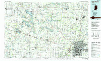
1984 Map of Fort Wayne
USGS Topo · Published 1985About this map
Winona Lake and the surrounding glacial lake district define the northern landscape of this mid-1980s planimetric study. The urban density of Fort Wayne transitions into a network of smaller agricultural and lakeside communities, where institutions like Manchester College in North Manchester and Concordia Theological Seminary anchor the region's cultural and educational life. The map details a sophisticated transportation grid, from the Interstate 69 corridor to the extensive rail lines of the Baltimore & Ohio RR and Norfolk & Western RR.
Find a feature on this map
266 named features on this map. Tap any name to fly to it.
Don’t see what you’re looking for? This feature index may not catch every label — zoom into the map to look around manually.
Map Details
Editions of this 1984 Fort Wayne Map
This is the sole edition of this map. No revisions or reprints were ever made.
Other maps of this area

1939 · Hamilton
USGS Topo · 1:24,000

1942 · Ashley
USGS Topo · 1:24,000

1942 · Stroh
USGS Topo · 1:24,000

1947 · Wolcottville
USGS Topo · 1:24,000

1947 · Oliver Lake
USGS Topo · 1:24,000

1948 · Hamilton
USGS Topo · 1:24,000

1950 · Leesburg
USGS Topo · 1:24,000

1950 · Pierceton
USGS Topo · 1:24,000

1950 · North Webster
USGS Topo · 1:24,000

1951 · Milford
USGS Topo · 1:24,000