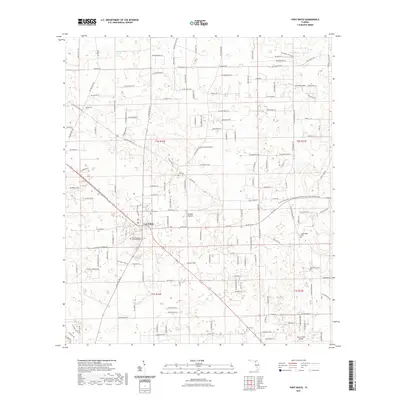
2021 Map of Fort White
USGS Topo · Published 2021About this map
Fort White serves as the central hub for this portion of southern Columbia County, where the intersection of SW State Rd 47 and Co RD 18 marks the town’s core. The area is characterized by a high concentration of small family and community burial grounds, including Elim Cem, Fort White Cem, Bethlehem Cem, and Shiloh Cem, which offer significant value for genealogical research in this rural corridor. Transportation is defined by a mix of established county roads and specialized facilities such as Bradley Airport. A notable recreational feature is the O Leno State Park to Ichetucknee Springs State Park Connector Trl, which traverses the landscape from east to west. Further south, the Lazy S Farm Airport and Tustenuggee Cem underscore the localized nature of industry and community landmarks in this Florida interior.
Find a feature on this map
29 named features on this map. Tap any name to fly to it.
Don’t see what you’re looking for? This feature index may not catch every label — zoom into the map to look around manually.
Map Details
Editions of this 2021 Fort White Map
This is the sole edition of this map. No revisions or reprints were ever made.
Other maps of this area

1954 · Gainesville
USGS Topo · 1:250,000

1954 · Valdosta
USGS Topo · 1:250,000

1958 · Valdosta
USGS Topo · 1:250,000

1958 · Gainesville
USGS Topo · 1:250,000

1959 · Valdosta
USGS Topo · 1:250,000

1959 · Gainesville
USGS Topo · 1:250,000

1962 · High Springs
USGS Topo · 1:24,000

1962 · Mikesville
USGS Topo · 1:24,000

1963 · Ellisville
USGS Topo · 1:24,000

1963 · Columbia
USGS Topo · 1:24,000