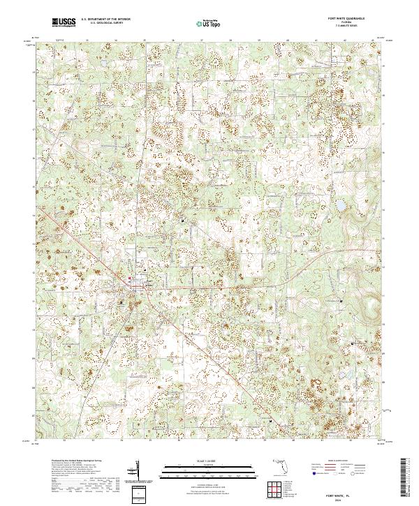
2024 Map of Fort White
USGS Topo · Published 2024About this map
Fort White serves as the central hub of this North Florida landscape, where a dense network of local roads and trails reflects a long-standing rural community structure. The map highlights a significant concentration of burial grounds, including Elim Cem, White Cem, and Heavenly Rest Cem near the town center, while Tustenuggee Cem and Bethlehem Cem sit further afield. These sites, often located near historical transit routes like Sw Old Wire Rd and Sw Elim Church Rd, provide essential landmarks for genealogical research in Columbia County.
Find a feature on this map
159 named features on this map. Tap any name to fly to it.
Don’t see what you’re looking for? This feature index may not catch every label — zoom into the map to look around manually.
Map Details
Editions of this 2024 Fort White Map
This is the sole edition of this map. No revisions or reprints were ever made.
Other maps of this area

1954 · Gainesville
USGS Topo · 1:250,000

1954 · Valdosta
USGS Topo · 1:250,000

1958 · Valdosta
USGS Topo · 1:250,000

1958 · Gainesville
USGS Topo · 1:250,000

1959 · Valdosta
USGS Topo · 1:250,000

1959 · Gainesville
USGS Topo · 1:250,000

1962 · High Springs
USGS Topo · 1:24,000

1962 · Mikesville
USGS Topo · 1:24,000

1963 · Ellisville
USGS Topo · 1:24,000

1963 · Columbia
USGS Topo · 1:24,000