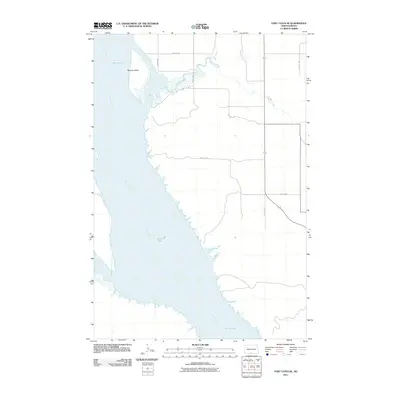
2011 Map of Fort Yates SE
USGS Topo · Published 2011About this map
The Missouri River dominates this portion of the Standing Rock Reservation, carving a wide path through the eastern edge of the Fort Yates District. The broad alluvial expanse of Kenel Flats lines the western banks, where the river's slow current has historically shaped the shifting landforms of the Missouri Trench. North of the flats, Winona Island sits as a prominent feature within the river's channel, reflecting the seasonal flow patterns that define this riparian environment.
Find a feature on this map
13 named features on this map. Tap any name to fly to it.
Don’t see what you’re looking for? This feature index may not catch every label — zoom into the map to look around manually.
Map Details
Editions of this 2011 Fort Yates SE Map
This is the sole edition of this map. No revisions or reprints were ever made.
Other maps of this area

1953 · McIntosh
USGS Topo · 1:250,000

1954 · Bismarck
USGS Topo · 1:250,000

1958 · Bismarck
USGS Topo · 1:250,000

1958 · McIntosh
USGS Topo · 1:250,000

1966 · Mahto NE
USGS Topo · 1:24,000

1966 · Mahto NW
USGS Topo · 1:24,000

1966 · Pollock NW
USGS Topo · 1:24,000

1968 · Fort Yates NW
USGS Topo · 1:24,000

1968 · Fort Yates SE
USGS Topo · 1:24,000

1968 · Fort Yates
USGS Topo · 1:24,000