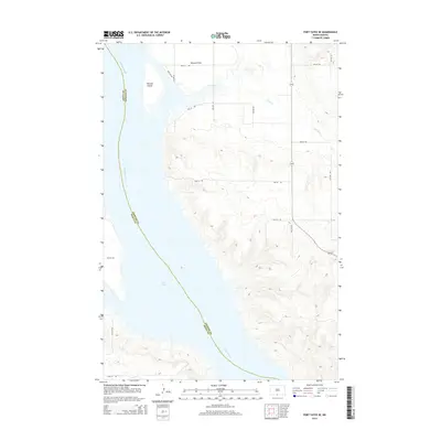
2014 Map of Fort Yates SE
USGS Topo · Published 2014About this map
Lake Oahe dominates the western half of this landscape, marking the expansive reach of the Missouri River as it defines the border between Sioux and Emmons counties. This 2014 survey illustrates the modern contours of the Missouri basin, where the water has submerged portions of the historical floodplain. Along the northeastern shore, Winona Flats and Winona Island remain prominent topographic features, hinting at the area's earlier geography before the stabilization of the reservoir. A sparse network of rural roads, including 90th St SW and 10th Ave SW, grid the high ground above the water. Small drainage systems like Cattail Cr cut through the bluffs, showing how the local hydrology feeds into the great river system. The map serves as a clear record of the intersection between the managed waters of the Oahe project and the surrounding prairie terrain.
Find a feature on this map
20 named features on this map. Tap any name to fly to it.
Don’t see what you’re looking for? This feature index may not catch every label — zoom into the map to look around manually.
Map Details
Editions of this 2014 Fort Yates SE Map
This is the sole edition of this map. No revisions or reprints were ever made.
Other maps of this area

1953 · McIntosh
USGS Topo · 1:250,000

1954 · Bismarck
USGS Topo · 1:250,000

1958 · Bismarck
USGS Topo · 1:250,000

1958 · McIntosh
USGS Topo · 1:250,000

1966 · Mahto NE
USGS Topo · 1:24,000

1966 · Mahto NW
USGS Topo · 1:24,000

1966 · Pollock NW
USGS Topo · 1:24,000

1968 · Fort Yates NW
USGS Topo · 1:24,000

1968 · Fort Yates SE
USGS Topo · 1:24,000

1968 · Fort Yates
USGS Topo · 1:24,000