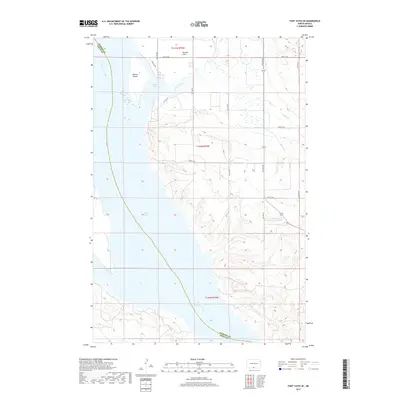
2017 Map of Fort Yates SE
USGS Topo · Published 2017About this map
The Missouri River defines the western edge of this landscape, marking the historical border between Emmons and Sioux counties. The central feature is the expansive Lake Oahe, which covers much of the river valley and creates a jagged eastern shoreline punctuated by Cattail Bay. This 2017 survey reflects the modern management of the Missouri's waters, showing the relationship between the reservoir and the low-lying terrain of Winona Flats.
Find a feature on this map
17 named features on this map. Tap any name to fly to it.
Don’t see what you’re looking for? This feature index may not catch every label — zoom into the map to look around manually.
Map Details
Editions of this 2017 Fort Yates SE Map
This is the sole edition of this map. No revisions or reprints were ever made.
Other maps of this area

1953 · McIntosh
USGS Topo · 1:250,000

1954 · Bismarck
USGS Topo · 1:250,000

1958 · Bismarck
USGS Topo · 1:250,000

1958 · McIntosh
USGS Topo · 1:250,000

1966 · Mahto NE
USGS Topo · 1:24,000

1966 · Mahto NW
USGS Topo · 1:24,000

1966 · Pollock NW
USGS Topo · 1:24,000

1968 · Fort Yates NW
USGS Topo · 1:24,000

1968 · Fort Yates SE
USGS Topo · 1:24,000

1968 · Fort Yates
USGS Topo · 1:24,000