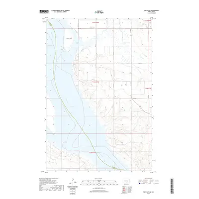
2020 Map of Fort Yates SE
USGS Topo · Published 2020About this map
Lake Oahe dominates the western portion of this landscape, formed by the impoundment of the Missouri River. The boundary between Emmons and Sioux counties follows the original river channel through the reservoir, passing east of Winona Island. The eastern shore features the wide, low-lying topography of Winona Flats and the protected inlet of Cattail Bay, where Cattail Cr meets the larger water body. This area reflects a modern riverine environment defined by large-scale water management and a regular grid of section roads, including 7th Ave SW and 90th St SW, which serve the agricultural uplands bordering the Missouri valley.
Find a feature on this map
24 named features on this map. Tap any name to fly to it.
Don’t see what you’re looking for? This feature index may not catch every label — zoom into the map to look around manually.
Map Details
Editions of this 2020 Fort Yates SE Map
This is the sole edition of this map. No revisions or reprints were ever made.
Other maps of this area

1953 · McIntosh
USGS Topo · 1:250,000

1954 · Bismarck
USGS Topo · 1:250,000

1958 · Bismarck
USGS Topo · 1:250,000

1958 · McIntosh
USGS Topo · 1:250,000

1966 · Mahto NE
USGS Topo · 1:24,000

1966 · Mahto NW
USGS Topo · 1:24,000

1966 · Pollock NW
USGS Topo · 1:24,000

1968 · Fort Yates NW
USGS Topo · 1:24,000

1968 · Fort Yates SE
USGS Topo · 1:24,000

1968 · Fort Yates
USGS Topo · 1:24,000