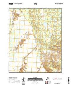
2018 Map of Fort Yukon A-1 NE
USGS Topo · Published 2018About this map
Vast wetland complexes and intricate hydrographic patterns characterize this portion of the Alaska interior within the Yukon-Koyukuk Census Area. This 2018 survey, based on data from the National Hydrography Dataset and SPOT imagery, details a landscape dominated by water and low-lying terrain, organized by the Public Land Survey System boundaries of T16n R17e and T16n R18e. The absence of roads or established settlements reflects the remote nature of the region, where the natural drainage of the land remains the primary defining characteristic. Researchers can examine the township and range divisions, including T15n R17e and T15n R18e, to understand the underlying cadastral framework used by the Bureau of Land Management to organize this undeveloped wilderness.
Find a feature on this map
4 named features on this map. Tap any name to fly to it.
Don’t see what you’re looking for? This feature index may not catch every label — zoom into the map to look around manually.
Map Details
Editions of this 2018 Fort Yukon A-1 NE Map
This is the sole edition of this map. No revisions or reprints were ever made.
Other maps of this area

1951 · Fort Yukon
USGS Topo · 1:250,000

1951 · Black River
USGS Topo · 1:250,000

1956 · Black River B-6
USGS Topo · 1:63,360

1956 · Fort Yukon B-1
USGS Topo · 1:63,360

1956 · Fort Yukon A-1
USGS Topo · 1:63,360

1956 · Black River A-6
USGS Topo · 1:63,360

1956 · Fort Yukon
USGS Topo · 1:250,000

1956 · Black River
USGS Topo · 1:250,000

1964 · Black River
USGS Topo · 1:250,000
2018 · Fort Yukon A-1 SW
USGS Topo · 1:25,000