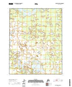
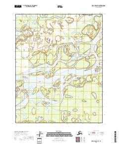
2018 Map of Fort Yukon B-5 NW
USGS Topo · Published 2018About this map
Yukon Flat dominates this landscape, characterized by a complex network of thousands of small water bodies and seasonal wetlands. The low-lying terrain of the Yukon Flat region is a vast floodplain where the meandering Lower Mouth Birch Creek flows toward the north. This specific section of the interior reveals the intricate hydrography of the Alaskan wilderness, where the lack of roads and permanent settlements reflects the seasonal pulse of the river system. At the southern end of the sheet, Canvasback Lake provides a major landmark within this dense cluster of ponds and sloughs. This 2018 survey captures the intricate boundary between permanent water and the shifting alluvial plains of the t18n r6e and t19n r7e townships, documenting a wilderness largely unchanged by modern infrastructure.
Find a feature on this map
7 named features on this map. Tap any name to fly to it.
Don’t see what you’re looking for? This feature index may not catch every label — zoom into the map to look around manually.
Map Details
Editions of this 2018 Fort Yukon B-5 NW Map
This is the sole edition of this map. No revisions or reprints were ever made.
Other maps of this area

1951 · Fort Yukon
USGS Topo · 1:250,000

1955 · Fort Yukon C-5
USGS Topo · 1:63,360

1956 · Fort Yukon B-6
USGS Topo · 1:63,360

1956 · Fort Yukon C-5
USGS Topo · 1:63,360

1956 · Fort Yukon B-5
USGS Topo · 1:63,360

1956 · Fort Yukon
USGS Topo · 1:250,000
1956 · Fort Yukon C-6
USGS Topo · 1:63,360
2018 · Fort Yukon C-5 SW
USGS Topo · 1:25,000
2018 · Fort Yukon B-6 SE
USGS Topo · 1:25,000
2018 · Fort Yukon C-5 SE
USGS Topo · 1:25,000