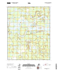
2018 Map of Fort Yukon C-4 SE
USGS Topo · Published 2018About this map
The Yukon River dominates this landscape in the eastern interior of Alaska, where its wide, braided channels create a complex network of islands and sandbars. Along the northern edge of the river's main course, Nuntragut Slough and Back Yukon Slough illustrate the dynamic nature of the waterway, showcasing how the river's path shifts across the low-lying terrain over time. This 2018 survey reveals a territory almost entirely defined by its hydrology, with countless unnamed ponds and wetlands filling the basins between the larger sloughs. While no permanent settlements are indicated, the map provides a detailed record of the river's morphology and the vast wetland ecosystems of the Yukon-Koyukuk region.
Find a feature on this map
9 named features on this map. Tap any name to fly to it.
Don’t see what you’re looking for? This feature index may not catch every label — zoom into the map to look around manually.
Map Details
Editions of this 2018 Fort Yukon C-4 SE Map
This is the sole edition of this map. No revisions or reprints were ever made.
Other maps of this area

1951 · Fort Yukon
USGS Topo · 1:250,000

1952 · Fort Yukon C-3
USGS Topo · 1:63,360

1952 · Fort Yukon C-4
USGS Topo · 1:63,360

1955 · Fort Yukon C-3
USGS Topo · 1:63,360

1956 · Fort Yukon B-4
USGS Topo · 1:63,360

1956 · Fort Yukon B-3
USGS Topo · 1:63,360

1956 · Fort Yukon
USGS Topo · 1:250,000
1956 · Fort Yukon C-4
USGS Topo · 1:63,360
2018 · Fort Yukon C-4 NW
USGS Topo · 1:25,000
2018 · Fort Yukon C-4 SW
USGS Topo · 1:25,000