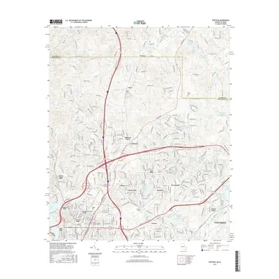
2017 Map of Fortson
USGS Topo · Published 2017About this map
Fortson and the surrounding Muscogee County suburbs appear here in a state of dense residential integration during the late 2010s. The landscape is defined by its complex network of water management features, including the Lindsey Creek Reservoir, Lake Heath, and several Bull Creek Watershed structures like Bull Creek Watershed Lake Number Four. This drainage pattern reflects the area's transition from rural Harris County borderlands to an extension of the Columbus metropolitan area. Local history is preserved in small pockets of the past, such as Mount Gilead Cem and Pierce Chapel Cem, which stand amidst modern developments and the arterial reach of Whitesville Rd. The presence of the Columbus Airport and the Columbus State Univ campus underscores the area's role as a regional hub for transportation and education, while traditional settlements like Nankipooh remain identified as distinct neighborhoods within the expanding city limits.
Find a feature on this map
327 named features on this map. Tap any name to fly to it.
Don’t see what you’re looking for? This feature index may not catch every label — zoom into the map to look around manually.
Map Details
Editions of this 2017 Fortson Map
This is the sole edition of this map. No revisions or reprints were ever made.
Other maps of this area

1907 · Talbotton
USGS Topo · 1:125,000

1907 · Opelika
USGS Topo · 1:125,000

1908 · Columbus
USGS Topo · 1:62,500

1909 · Opelika
USGS Topo · 1:125,000

1914 · Seale
USGS Topo · 1:62,500

1929 · Columbus
USGS Topo · 1:48,000

1947 · Columbus
USGS Topo · 1:62,500

1949 · Midland
USGS Topo · 1:24,000

1949 · Ochillee
USGS Topo · 1:24,000

1949 · Columbus
USGS Topo · 1:24,000