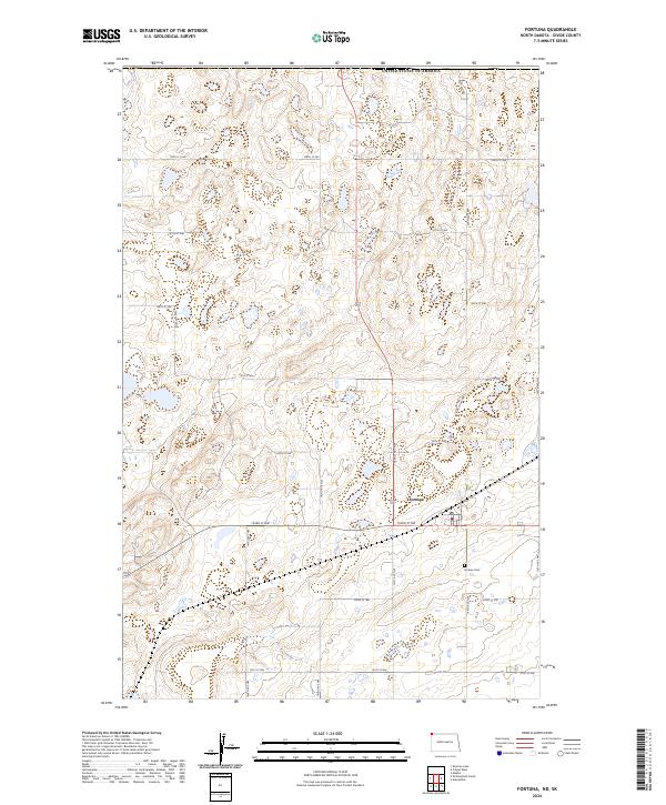
2024 Map of Fortuna
USGS Topo · Published 2024About this map
The small community of Fortuna sits in the northwestern corner of North Dakota, just south of the border with the United States of America. This landscape is defined by the unique prairie pothole topography of Divide County, where numerous small wetlands and basins are protected within the Divide County Waterfowl Production Area. These conservation tracts, often labeled simply as Dcw Pa, are interspersed among a strictly rectilinear grid of section roads including 143rd Ave NW and 103rd St NW. Local history is anchored by the Fortuna Cem located southeast of the main settlement. The map provides a detailed view of the rural township structure across several jurisdictions, including t163n r101w, where the agricultural and conservation interests of the High Plains meet.
Find a feature on this map
24 named features on this map. Tap any name to fly to it.
Don’t see what you’re looking for? This feature index may not catch every label — zoom into the map to look around manually.
Map Details
Editions of this 2024 Fortuna Map
This is the sole edition of this map. No revisions or reprints were ever made.
Other maps of this area

1953 · Williston
USGS Topo · 1:250,000

1957 · Williston
USGS Topo · 1:250,000

1983 · Colgan West
USGS Topo · 1:24,000

1983 · Writing Rock North
USGS Topo · 1:24,000

1983 · Alkabo
USGS Topo · 1:24,000

1983 · Alexandria
USGS Topo · 1:24,000
1983 · Fortuna
USGS Topo · 1:24,000
1983 · Skjermo Lake
USGS Topo · 1:24,000

1984 · Crosby
USGS Topo · 1:100,000
2011 · Writing Rock North
USGS Topo · 1:24,000