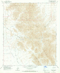
1965 Map of Fortuna Mine
USGS Topo · Published 1966About this map
The Gila Mountains dominate this mid-century survey of the Yuma Desert, revealing a landscape defined by historic mining and military boundaries. The Fortuna Mine is the most prominent industrial landmark, accompanied by its associated Tailings and the nearby Golden Dream Mine. These sites speak to the era of prospecting that brought travelers through the arid corridor of the Camino Del Diablo, an ancient and notoriously difficult route that crosses the southwestern portion of the map. Much of the high ground, including Red Top Mtn and Vopoki Ridge, falls within the Luke Air Force Range, highlighting the post-war transition of these desert reaches into military training grounds. Crucial water sources for early travelers and miners, such as Dripping Spring and Sheep Tank, are noted among the steep draws of the range.
Find a feature on this map
22 named features on this map. Tap any name to fly to it.
Don’t see what you’re looking for? This feature index may not catch every label — zoom into the map to look around manually.
Map Details
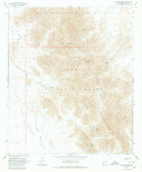
Editions of this 1965 Fortuna Mine Map
2 editions found
Other maps of this area

1926 · Fortuna
USGS Topo · 1:62,500

1926 · Wellton
USGS Topo · 1:62,500

1929 · Fortuna
USGS Topo · 1:62,500

1929 · Wellton
USGS Topo · 1:62,500

1942 · Yuma
USGS Topo · 1:250,000

1954 · El Centro
USGS Topo · 1:250,000

1955 · El Centro
USGS Topo · 1:250,000

1958 · El Centro
USGS Topo · 1:250,000

1961 · El Centro
USGS Topo · 1:250,000

1964 · El Centro
USGS Topo · 1:250,000