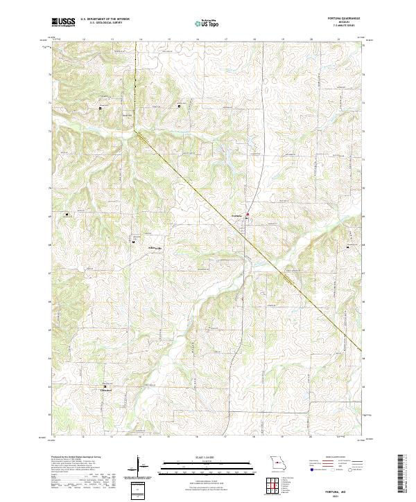
2021 Map of Fortuna
USGS Topo · Published 2021About this map
The border of Moniteau and Morgan counties serves as the central axis for this rural Missouri landscape, where agricultural land is segmented by a network of drainage branches and creeks. Small settlements like Fortuna and Aikinsville anchor the region, connected by a grid of named roads including State Hwy W and Manito Lake Rd. The map reveals a dense distribution of family and community burial grounds, such as Stone Cem, Liberty Cem, and the Alkinsville Cem, providing valuable location data for genealogists tracking early residents of the central Missouri plains.
Find a feature on this map
62 named features on this map. Tap any name to fly to it.
Don’t see what you’re looking for? This feature index may not catch every label — zoom into the map to look around manually.
Map Details
Editions of this 2021 Fortuna Map
This is the sole edition of this map. No revisions or reprints were ever made.
Other maps of this area

1888 · Versailles
USGS Topo · 1:125,000

1888 · Boonville
USGS Topo · 1:125,000

1893 · Versailles
USGS Topo · 1:125,000

1904 · Eldon
USGS Topo · 1:62,500

1904 · Gravois Mills
USGS Topo · 1:62,500

1947 · Jefferson City
USGS Topo · 1:250,000

1949 · Gravois Mills
USGS Topo · 1:62,500

1951 · Latham
USGS Topo · 1:24,000

1952 · Tipton
USGS Topo · 1:24,000
1952 · Clarksburg
USGS Topo · 1:24,000