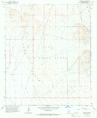
1965 Map of Fortuna SW
USGS Topo · Published 1966About this map
The Yuma Desert landscape dominates this 1960s survey, defined by the expansive Luke Air Force Range. This area is characterized by shifting sands and alluvial plains, marked by specific military training features such as a Target and Arena 432. The map details the precise topography of the desert floor, with scattered benchmarks and various survey markers like Guide and Target lines crossing the terrain. A sparse network of Jeep Trails provides the only recorded access through this arid environment, connecting to an Approximate West Route in the northeastern corner. Mapping this quadrant involved a multi-agency effort, synthesizing data from the Bureau of Reclamation and aerial photography to document the desert's changing surface during the mid-20th century.
Find a feature on this map
10 named features on this map. Tap any name to fly to it.
Don’t see what you’re looking for? This feature index may not catch every label — zoom into the map to look around manually.
Map Details
Editions of this 1965 Fortuna SW Map
3 editions found
Other maps of this area

1903 · Yuma
USGS Topo · 1:125,000

1905 · Yuma
USGS Topo · 1:125,000

1926 · Fortuna
USGS Topo · 1:62,500

1929 · Fortuna
USGS Topo · 1:62,500

1940 · Yuma
USGS Topo · 1:62,500

1942 · Yuma
USGS Topo · 1:250,000

1945 · Yuma
USGS Topo · 1:62,500

1952 · Yuma East
USGS Topo · 1:24,000

1954 · El Centro
USGS Topo · 1:250,000

1955 · El Centro
USGS Topo · 1:250,000