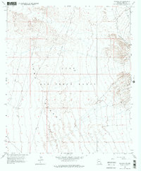
1965 Map of Fortuna SW
USGS Topo · Published 1975About this map
Yuma Desert topography dominates this mid-1960s survey, illustrating a landscape primarily defined by military activity and ancient transit routes. The most significant historical feature is the Camino Del Diablo (Approximate Route), the legendary "Road of the Devil" that has funneled travelers through this arid corridor for centuries. Much of the mapped area is under the jurisdiction of the Luke Air Force Range, reflected in the presence of various Target markers and an Arena situated among the drainage patterns of Fortuna Wash.
Find a feature on this map
7 named features on this map. Tap any name to fly to it.
Don’t see what you’re looking for? This feature index may not catch every label — zoom into the map to look around manually.
Map Details
Editions of this 1965 Fortuna SW Map
3 editions found
Other maps of this area

1903 · Yuma
USGS Topo · 1:125,000

1905 · Yuma
USGS Topo · 1:125,000

1926 · Fortuna
USGS Topo · 1:62,500

1929 · Fortuna
USGS Topo · 1:62,500

1940 · Yuma
USGS Topo · 1:62,500

1942 · Yuma
USGS Topo · 1:250,000

1945 · Yuma
USGS Topo · 1:62,500

1952 · Yuma East
USGS Topo · 1:24,000

1954 · El Centro
USGS Topo · 1:250,000

1955 · El Centro
USGS Topo · 1:250,000