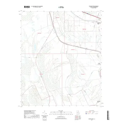
2018 Map of Fortune Fork
USGS Topo · Published 2018About this map
Roundaway Bayou and a complex network of wetlands define the landscape of Madison Parish in this modern survey. The area around Fortune Fork is characterized by its agricultural heritage, evidenced by the presence of the Red Beard Dusting Service Airport and numerous rural roads like Sevier-Watts Rd and Afton Rd. The topography is heavily influenced by oxbow formations and meandering waterways, including Horseshoe Lake and Alligator Lake, which suggest the historic path of larger river systems. Genealogists and local historians can locate established burial sites such as Mount Celia Cem near the northern border and Montrose Cem further south. The map provides a clear view of the transition between the managed farmland and the dense bottomland hydrology of Brushy Bayou and the Roundaway Bayou Vidal Cutoff.
Find a feature on this map
26 named features on this map. Tap any name to fly to it.
Don’t see what you’re looking for? This feature index may not catch every label — zoom into the map to look around manually.
Map Details
Editions of this 2018 Fortune Fork Map
This is the sole edition of this map. No revisions or reprints were ever made.
Other maps of this area

1909 · Millikens Bend
USGS Topo · 1:24,000

1909 · Tallulah
USGS Topo · 1:24,000

1909 · Mound
USGS Topo · 1:24,000

1910 · Mound
USGS Topo · 1:31,680

1935 · Waverly
USGS Topo · 1:62,500

1935 · Shackleford Lake
USGS Topo · 1:62,500

1939 · Talla Bena
USGS Topo · 1:62,500

1955 · Jackson
USGS Topo · 1:250,000

1958 · Shackleford Lake
USGS Topo · 1:62,500

1961 · Jackson
USGS Topo · 1:250,000