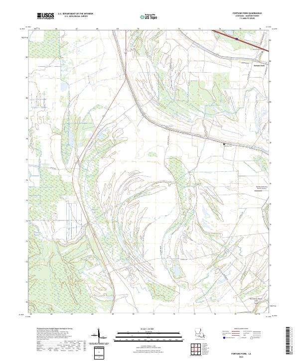
2024 Map of Fortune Fork
USGS Topo · Published 2024About this map
Tensas River National Wildlife Refuge anchors the southwestern portion of this Madison Parish quadrangle, preserving a landscape defined by an intricate network of wetlands and bayous. The small settlement of Fortune Fork sits in the northeast, positioned near a complex of water bodies including Brushy Bayou, Gar Bayou, and Roundaway Bayou. The land reflects a pattern of large-scale agriculture and conservation, evidenced by the Farm Service Agency Interest of Louisiana and the Red Beard Dusting Service Airport, which supports local crop-dusting operations.
Find a feature on this map
29 named features on this map. Tap any name to fly to it.
Don’t see what you’re looking for? This feature index may not catch every label — zoom into the map to look around manually.
Map Details
Editions of this 2024 Fortune Fork Map
This is the sole edition of this map. No revisions or reprints were ever made.
Other maps of this area

1909 · Millikens Bend
USGS Topo · 1:24,000

1909 · Tallulah
USGS Topo · 1:24,000

1909 · Mound
USGS Topo · 1:24,000

1910 · Mound
USGS Topo · 1:31,680

1935 · Waverly
USGS Topo · 1:62,500

1935 · Shackleford Lake
USGS Topo · 1:62,500

1939 · Talla Bena
USGS Topo · 1:62,500

1955 · Jackson
USGS Topo · 1:250,000

1958 · Shackleford Lake
USGS Topo · 1:62,500

1961 · Jackson
USGS Topo · 1:250,000