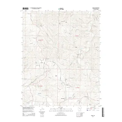
2014 Map of Forum
USGS Topo · Published 2014About this map
Forum sits at the junction of Ar-23 and N Highway 127, anchoring a landscape of deep hollows and high ridges in Madison County. The terrain is defined by the winding course of the Kings River to the east and the headwaters of War Eagle Creek and Smyrna Br to the west. This geography created isolated pockets of settlement, seen in the distinct locations of Alabam and Old Alabam.
Find a feature on this map
89 named features on this map. Tap any name to fly to it.
Don’t see what you’re looking for? This feature index may not catch every label — zoom into the map to look around manually.
Map Details
Editions of this 2014 Forum Map
This is the sole edition of this map. No revisions or reprints were ever made.
Other maps of this area

1900 · Eureka Springs
USGS Topo · 1:125,000

1901 · Eureka Springs
USGS Topo · 1:125,000

1945 · Harrison
USGS Topo · 1:250,000

1949 · Harrison
USGS Topo · 1:250,000

1954 · Harrison
USGS Topo · 1:250,000

1957 · Mundell
USGS Topo · 1:24,000

1958 · Hindsville
USGS Topo · 1:24,000

1958 · Harrison
USGS Topo · 1:250,000

1964 · Harrison
USGS Topo · 1:250,000
1972 · Rockhouse
USGS Topo · 1:24,000