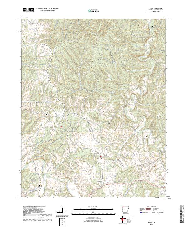
2024 Map of Forum
USGS Topo · Published 2024About this map
War Eagle Creek and the Kings River carve a dissected landscape through this portion of Madison County, framing a region defined by its narrow hollows and high ridges. The settlement pattern follows the drainage of the creeks, with Forum situated near the headwaters of Holman Creek and Alabam located further south along the winding road network. The map reveals the shift from Old Alabam to its more contemporary namesake, providing a geographic record of local movement and community development.
Find a feature on this map
94 named features on this map. Tap any name to fly to it.
Don’t see what you’re looking for? This feature index may not catch every label — zoom into the map to look around manually.
Map Details
Editions of this 2024 Forum Map
This is the sole edition of this map. No revisions or reprints were ever made.
Other maps of this area

1900 · Eureka Springs
USGS Topo · 1:125,000

1901 · Eureka Springs
USGS Topo · 1:125,000

1945 · Harrison
USGS Topo · 1:250,000

1949 · Harrison
USGS Topo · 1:250,000

1954 · Harrison
USGS Topo · 1:250,000

1957 · Mundell
USGS Topo · 1:24,000

1958 · Hindsville
USGS Topo · 1:24,000

1958 · Harrison
USGS Topo · 1:250,000

1964 · Harrison
USGS Topo · 1:250,000
1972 · Rockhouse
USGS Topo · 1:24,000