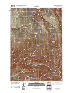
2011 Map of Fossil North
USGS Topo · Published 2011About this map
Mayville stands as a focal point in this portion of Wheeler County, where the Mayville Post Office and nearby Mayville Cemetery anchor a landscape defined by ranching and high-desert drainage systems. The northern reaches of Fossil appear at the southern margin, connected to the hinterlands by routes like Hoover Creek Rd and Black Butte Rd. The terrain is deeply incised by canyons such as Ramsey Canyon, Springston Canyon, and the vividly named Jump Off Joe Canyon. Agricultural and infrastructure markers, including Putnams Airfield and the Hoover Creek Reservoir, illustrate the management of this arid environment. Significant elevations like Black Butte and Cummings Hill Summit overlook the winding courses of North Fork Butte Creek and Smith Creek, providing a clear view of the rural settlement patterns in the early 21st century.
Find a feature on this map
33 named features on this map. Tap any name to fly to it.
Don’t see what you’re looking for? This feature index may not catch every label — zoom into the map to look around manually.
Map Details
Editions of this 2011 Fossil North Map
This is the sole edition of this map. No revisions or reprints were ever made.
Other maps of this area

1916 · Condon
USGS Topo · 1:125,000

1926 · Mitchell
USGS Topo · 1:125,000

1953 · The Dalles
USGS Topo · 1:250,000

1955 · Bend
USGS Topo · 1:250,000

1956 · The Dalles
USGS Topo · 1:250,000

1957 · Bend
USGS Topo · 1:250,000

1957 · The Dalles
USGS Topo · 1:250,000

1958 · Bend
USGS Topo · 1:250,000

1966 · Kinzua
USGS Topo · 1:62,500

1966 · Clarno
USGS Topo · 1:62,500