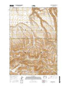
2017 Map of Fossil North
USGS Topo · Published 2017About this map
The town of Fossil and the settlement of Mayville anchor this corner of North Central Oregon, where the landscape is defined by deep canyons and prominent volcanic landmarks. The boundary between Gilliam Co and Wheeler Co cuts across the northern half of the sheet, dividing a high plateau punctuated by Beecher Flat and Black Butte. For genealogists and local historians, the Masonic Cemetery at the southern edge and the Mayville Cemetery to the north provide critical points of interest for family research. Water management in this arid climate is visible at the Hoover Creek Reservoir, while the rugged natural topography is mapped through named features like Dead Horse Canyon, Patill Canyon, and Cave Hollow. The road network, including Hoover Creek Road and Butte Creek Road, follows the natural drainage patterns of North Fork Butte Creek.
Find a feature on this map
39 named features on this map. Tap any name to fly to it.
Don’t see what you’re looking for? This feature index may not catch every label — zoom into the map to look around manually.
Map Details
Editions of this 2017 Fossil North Map
This is the sole edition of this map. No revisions or reprints were ever made.
Other maps of this area

1916 · Condon
USGS Topo · 1:125,000

1926 · Mitchell
USGS Topo · 1:125,000

1953 · The Dalles
USGS Topo · 1:250,000

1955 · Bend
USGS Topo · 1:250,000

1956 · The Dalles
USGS Topo · 1:250,000

1957 · Bend
USGS Topo · 1:250,000

1957 · The Dalles
USGS Topo · 1:250,000

1958 · Bend
USGS Topo · 1:250,000

1966 · Kinzua
USGS Topo · 1:62,500

1966 · Clarno
USGS Topo · 1:62,500