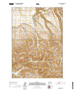
2020 Map of Fossil North
USGS Topo · Published 2020About this map
Fossil sits at the southern edge of this Wheeler County terrain, where the street grid of W Broadway meets the complex drainage systems of north-central Oregon. The landscape is defined by deep incisions like Greasewood Canyon, Patill Canyon, and Ramsey Canyon, revealing a high-plateau geography dominated by landmarks such as Black Butte and the Cummings Hill Summit.
Find a feature on this map
40 named features on this map. Tap any name to fly to it.
Don’t see what you’re looking for? This feature index may not catch every label — zoom into the map to look around manually.
Map Details
Editions of this 2020 Fossil North Map
This is the sole edition of this map. No revisions or reprints were ever made.
Other maps of this area

1916 · Condon
USGS Topo · 1:125,000

1926 · Mitchell
USGS Topo · 1:125,000

1953 · The Dalles
USGS Topo · 1:250,000

1955 · Bend
USGS Topo · 1:250,000

1956 · The Dalles
USGS Topo · 1:250,000

1957 · Bend
USGS Topo · 1:250,000

1957 · The Dalles
USGS Topo · 1:250,000

1958 · Bend
USGS Topo · 1:250,000

1966 · Kinzua
USGS Topo · 1:62,500

1966 · Clarno
USGS Topo · 1:62,500