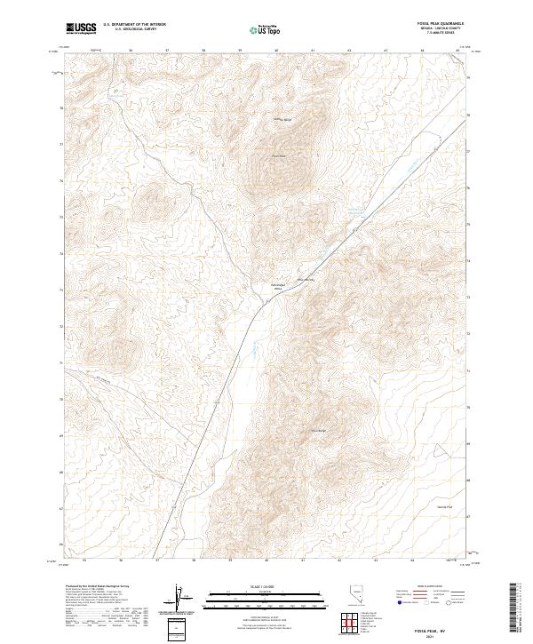
2021 Map of Fossil Peak
USGS Topo · Published 2021About this map
Fossil Peak stands as a prominent landmark at the convergence of several distinct topographical regions within the Seaman Range. This 2021 survey documents the hydrological and transportation patterns of the Pahranagat Valley corridor, where the White River threads through the Hiko Narrows. The landscape is defined by the sharp transition between these high ranges and the level expanse of Sixmile Flat.
Find a feature on this map
11 named features on this map. Tap any name to fly to it.
Don’t see what you’re looking for? This feature index may not catch every label — zoom into the map to look around manually.
Map Details
Editions of this 2021 Fossil Peak Map
This is the sole edition of this map. No revisions or reprints were ever made.
Other maps of this area

1954 · Caliente
USGS Topo · 1:250,000

1959 · Caliente
USGS Topo · 1:250,000

1970 · Hiko NE
USGS Topo · 1:24,000

1970 · Hiko SE
USGS Topo · 1:24,000

1970 · Seaman Wash
USGS Topo · 1:24,000

1970 · Fossil Peak
USGS Topo · 1:24,000
1970 · White River Narrows
USGS Topo · 1:24,000

1970 · Hiko
USGS Topo · 1:24,000

1985 · Mail Summit
USGS Topo · 1:24,000
1985 · Mount Irish SE
USGS Topo · 1:24,000