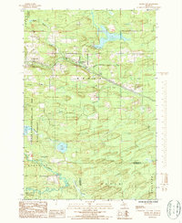
1986 Map of Foster City
USGS Topo · Published 1986About this map
The Sturgeon River and its numerous tributaries, including Schultz Creek and Pocans Creek, define the drainage and topography of this Upper Peninsula landscape. Near the settlement of Foster City, the presence of a Cem and the Old Railroad Grade indicates a legacy of early transport and local community development during the mid-to-late 20th century. The industrial character of the region is grounded by several instances of Rock Quarry sites and a Gage Station located along the river.
Find a feature on this map
31 named features on this map. Tap any name to fly to it.
Don’t see what you’re looking for? This feature index may not catch every label — zoom into the map to look around manually.
Map Details
Editions of this 1986 Foster City Map
This is the sole edition of this map. No revisions or reprints were ever made.
Other maps of this area

1954 · Escanaba
USGS Topo · 1:250,000

1955 · Vulcan
USGS Topo · 1:24,000

1955 · Norway
USGS Topo · 1:62,500

1955 · Ralph
USGS Topo · 1:62,500

1956 · Foster City
USGS Topo · 1:62,500

1957 · Escanaba
USGS Topo · 1:250,000

1957 · Northland
USGS Topo · 1:62,500

1958 · Escanaba
USGS Topo · 1:250,000

1958 · Marquette
USGS Topo · 1:250,000

1960 · Marquette
USGS Topo · 1:250,000