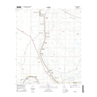
2015 Map of Foules
USGS Topo · Published 2015About this map
Tensas River landings and bayous define this landscape on the borders of Catahoula Parish and Tensas Parish. The terrain is characterized by a complex network of waterways, including Little Tiger Bayou, Steep Bayou, and the meandering Big Choctaw Bayou. The distribution of named landings such as Eltringham Landing, Copeland Landing, and Kirks Landing along the riverbanks highlights the area's enduring connection to waterborne transport and commerce. Small settlements and points of interest like Foules, Greenville, and Maitland serve as local hubs, while family and community landmarks such as Elder Shade Cem and Greenville Cem provide valuable touchpoints for genealogical research. The northern portion of Concordia Parish also appears, showing a geography shaped by seasonal water levels and agricultural drainage near Black Lake and Reed Lake.
Find a feature on this map
71 named features on this map. Tap any name to fly to it.
Don’t see what you’re looking for? This feature index may not catch every label — zoom into the map to look around manually.
Map Details
Editions of this 2015 Foules Map
This is the sole edition of this map. No revisions or reprints were ever made.
Other maps of this area

1921 · Natchez
USGS Topo · 1:48,000

1922 · Natchez
USGS Topo · 1:62,500

1939 · Red Gum
USGS Topo · 1:62,500

1939 · Natchez
USGS Topo · 1:62,500

1939 · Locust Ridge
USGS Topo · 1:62,500

1941 · Sicily Island
USGS Topo · 1:62,500

1953 · Natchez
USGS Topo · 1:250,000

1956 · Natchez
USGS Topo · 1:250,000

1957 · Sicily Island
USGS Topo · 1:62,500

1959 · Natchez
USGS Topo · 1:250,000