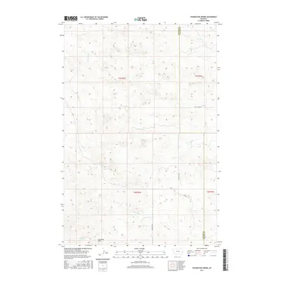
2017 Map of Foundation Spring
USGS Topo · Published 2017About this map
Foundation Spring and the headwaters of several drainages define this portion of the eastern Montana plains on the border of Custer and Fallon counties. The landscape is carved by a network of intermittent watercourses, including Locate Creek and its North Fork, which flow through the western sections. The area is largely defined by the drainage divide between these western creeks and Spring Creek to the northeast. Sparse infrastructure, such as Foundation Road and County Road 431, follows the natural contours and section lines of the Public Land Survey System. These roads connect the ranching country near Foundation Draw to the surrounding hills. The topography is dominated by the erosion patterns of Hay Creek and Miles City Creek, revealing a remote ranching environment at the turn of the 21st century.
Find a feature on this map
17 named features on this map. Tap any name to fly to it.
Don’t see what you’re looking for? This feature index may not catch every label — zoom into the map to look around manually.
Map Details
Editions of this 2017 Foundation Spring Map
This is the sole edition of this map. No revisions or reprints were ever made.
Other maps of this area

1953 · Miles City
USGS Topo · 1:250,000

1957 · Miles City
USGS Topo · 1:250,000

1958 · Miles City
USGS Topo · 1:250,000

1969 · Knowlton
USGS Topo · 1:24,000

1969 · Tepee Butte NE
USGS Topo · 1:24,000

1969 · Montague Butte
USGS Topo · 1:24,000
1980 · Miles City
USGS Topo · 1:100,000

1981 · Baker
USGS Topo · 1:100,000
1981 · Bracket Butte
USGS Topo · 1:24,000

1981 · Nelson Butte
USGS Topo · 1:24,000