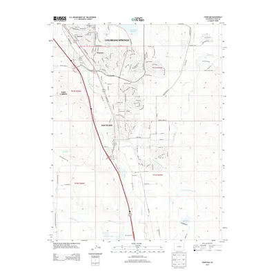
2013 Map of Fountain
USGS Topo · Published 2013About this map
Fountain and the surrounding residential developments of Security and Widefield dominate this southern extension of Colorado Springs. The map illustrates a complex network of suburban expansion and agricultural infrastructure, where the Fountain Creek corridor serves as a primary artery for both transportation and water management. Irrigation systems like the Chilcotte Canal Number 27 and Fountain Ditch snake through the landscape, alongside significant water bodies including the Big Johnson Reservoir and Callahan Reservoir. To the west, the Fort Carson boundary defines the edge of urban growth, while local landmarks such as Fairview Cem and Middle Bay Cem provide important points of reference for genealogists and local historians. The varied terrain, from Skinner Hill to the banks of Jimmy Camp Creek, highlights the transition from the high plains to the foothills.
Find a feature on this map
131 named features on this map. Tap any name to fly to it.
Don’t see what you’re looking for? This feature index may not catch every label — zoom into the map to look around manually.
Map Details
Editions of this 2013 Fountain Map
This is the sole edition of this map. No revisions or reprints were ever made.
Other maps of this area

1893 · Colorado Springs
USGS Topo · 1:125,000

1909 · Colorado Springs
USGS Topo · 1:125,000

1942 · Colorado Springs
USGS Topo · 1:125,000

1948 · Timber Mountain
USGS Topo · 1:24,000

1948 · Fountain SE
USGS Topo · 1:24,000

1948 · Colorado Springs
USGS Topo · 1:62,500

1948 · Fountain
USGS Topo · 1:24,000

1948 · Colorado Springs
USGS Topo · 1:24,000

1948 · Cheyenne Mountain
USGS Topo · 1:24,000

1948 · Falcon
USGS Topo · 1:62,500