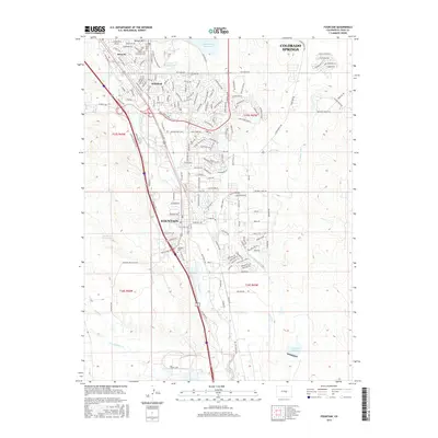
2016 Map of Fountain
USGS Topo · Published 2016About this map
Fountain and its surrounding suburbs of Security and Widefield sit along the drainage of Fountain Cr in this modern topographic survey of El Paso County. The landscape is defined by its complex water management systems, featuring the Big Johnson Reservoir and an intricate network of irrigation and transport channels like Fountain Ditch and the Chilcotte Canal Number 2. These features demonstrate the critical role of water infrastructure in supporting the development south of Colorado Springs. To the east, the terrain transitions into the draws of Jimmy Camp Cr, while local landmarks like Skinner Hill and the Fairview Cem provide points of reference for local historians. The map also documents the modern residential footprint, with extensive street grids such as Mesa Ridge Pkwy and Fontaine Blvd connecting these growing communities.
Find a feature on this map
88 named features on this map. Tap any name to fly to it.
Don’t see what you’re looking for? This feature index may not catch every label — zoom into the map to look around manually.
Map Details
Editions of this 2016 Fountain Map
This is the sole edition of this map. No revisions or reprints were ever made.
Other maps of this area

1893 · Colorado Springs
USGS Topo · 1:125,000

1909 · Colorado Springs
USGS Topo · 1:125,000

1942 · Colorado Springs
USGS Topo · 1:125,000

1948 · Timber Mountain
USGS Topo · 1:24,000

1948 · Fountain SE
USGS Topo · 1:24,000

1948 · Colorado Springs
USGS Topo · 1:62,500

1948 · Fountain
USGS Topo · 1:24,000

1948 · Colorado Springs
USGS Topo · 1:24,000

1948 · Cheyenne Mountain
USGS Topo · 1:24,000

1948 · Falcon
USGS Topo · 1:62,500