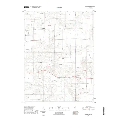
2018 Map of Fountain Green
USGS Topo · Published 2018About this map
Fountain Green serves as the central hub of this rural Illinois landscape, situated at the intersection of a grid-like network of county roads. The terrain is defined by the winding course of the La Moine River and its East Fork, which carve through the till plains to create distinct natural features like Rattlesnake Den Hollow. A high density of family and community burial grounds, including the Lincoln Catholic Cem and Mourning Cem, indicates a deeply rooted local history and long-standing agricultural settlement patterns. Smaller hamlets like Webster and Joetta are connected by routes such as Co HWY 8 and Co RD 50 E, reflecting the enduring rural infrastructure of Hancock and McDonough Counties. The map also highlights specific landmarks like Vishnu Springs, suggesting localized water sources that shaped the early development of this prairie region.
Find a feature on this map
71 named features on this map. Tap any name to fly to it.
Don’t see what you’re looking for? This feature index may not catch every label — zoom into the map to look around manually.
Map Details
Editions of this 2018 Fountain Green Map
This is the sole edition of this map. No revisions or reprints were ever made.
Other maps of this area

1913 · Colchester
USGS Topo · 1:62,500

1918 · La Harpe
USGS Topo · 1:62,500

1932 · Lomax
USGS Topo · 1:62,500

1933 · Carthage
USGS Topo · 1:62,500

1937 · Carthage
USGS Topo · 1:62,500

1937 · Lomax
USGS Topo · 1:62,500

1958 · Burlington
USGS Topo · 1:250,000

1961 · Burlington
USGS Topo · 1:250,000

1963 · Burlington
USGS Topo · 1:250,000
1964 · Burnside
USGS Topo · 1:24,000