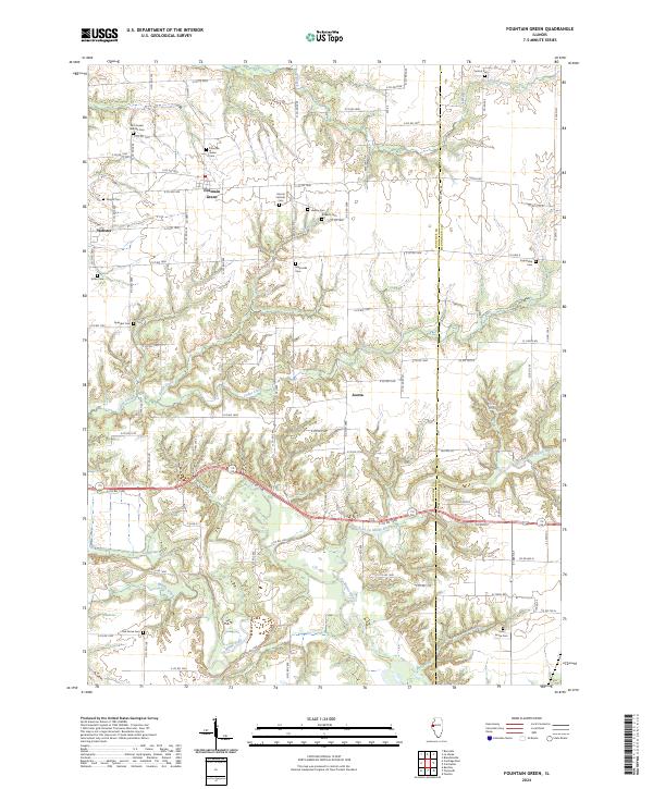
2024 Map of Fountain Green
USGS Topo · Published 2024About this map
Fountain Green and the surrounding agricultural townships of eastern Hancock County are defined by a network of historic family cemeteries and the winding course of the East Fork La Moine River. This landscape reveals a settlement pattern dictated by the local drainage, where small communities like Joetta and Webster grew alongside tributaries such as Cedar Creek and Fisher Creek. The high concentration of burial grounds, including the Lincoln Catholic Cem and Majorville Cem, provides significant genealogical touchpoints for tracing the 19th-century families who established these rural prairie outposts. Further south, the terrain becomes more varied as the La Moine River cuts through the region, creating the distinct topography of Rattlesnake Den Hollow near the Hills Grove Cem, contrasting with the orderly grid of farm roads and county routes that crisscross the northern uplands.
Find a feature on this map
64 named features on this map. Tap any name to fly to it.
Don’t see what you’re looking for? This feature index may not catch every label — zoom into the map to look around manually.
Map Details
Editions of this 2024 Fountain Green Map
This is the sole edition of this map. No revisions or reprints were ever made.
Other maps of this area

1913 · Colchester
USGS Topo · 1:62,500

1918 · La Harpe
USGS Topo · 1:62,500

1932 · Lomax
USGS Topo · 1:62,500

1933 · Carthage
USGS Topo · 1:62,500

1937 · Carthage
USGS Topo · 1:62,500

1937 · Lomax
USGS Topo · 1:62,500

1958 · Burlington
USGS Topo · 1:250,000

1961 · Burlington
USGS Topo · 1:250,000

1963 · Burlington
USGS Topo · 1:250,000
1964 · Burnside
USGS Topo · 1:24,000