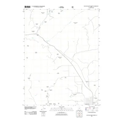
2011 Map of Fountain Green North
USGS Topo · Published 2011About this map
Fountain Green serves as the primary settlement on this map, situated at the base of a high plateau where the valley floor transitions into the San Pitch Mountains. The town's layout is clearly defined by residential blocks and vital local institutions, including the Fountain Green Post Office and the Fountain Green Cemetery. Agricultural and industrial water management is evident in the presence of the Fountain Green Fish Hatchery, which utilizes the perennial flow of Gammett Creek and Big Springs.
Find a feature on this map
49 named features on this map. Tap any name to fly to it.
Don’t see what you’re looking for? This feature index may not catch every label — zoom into the map to look around manually.
Map Details
Editions of this 2011 Fountain Green North Map
This is the sole edition of this map. No revisions or reprints were ever made.
Other maps of this area

1885 · Manti
USGS Topo · 1:250,000

1895 · Manti
USGS Topo · 1:250,000

1951 · Moroni
USGS Topo · 1:62,500

1951 · Santaquin
USGS Topo · 1:62,500

1951 · Nephi
USGS Topo · 1:62,500

1952 · Santaquin Peak
USGS Topo · 1:62,500

1956 · Price
USGS Topo · 1:250,000

1960 · Price
USGS Topo · 1:250,000

1962 · Price
USGS Topo · 1:250,000
1979 · Mona
USGS Topo · 1:24,000