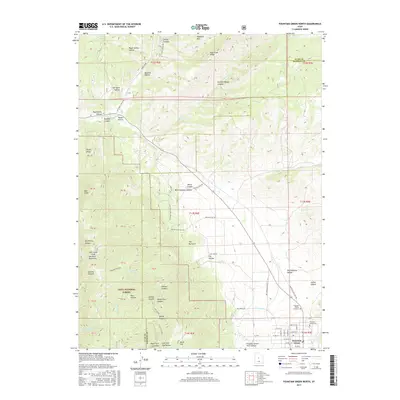
2017 Map of Fountain Green North
USGS Topo · Published 2017About this map
Fountain Green anchors the southeastern corner of this landscape, where the Sanpete County valley meets the rising elevations of the San Pitch Mountains and the Uinta National Forest. This 2017 survey shows the town's grid expanding into the foothills, marked by significant local landmarks like the Fountain Green Cem and the Yorgason Family Cemetary. The area is defined by a complex network of canyons and ridges, including Rocky Ridge and Salt Creek Peak, which channel numerous water sources such as Big Springs and Bradley Springs toward the valley floor.
Find a feature on this map
72 named features on this map. Tap any name to fly to it.
Don’t see what you’re looking for? This feature index may not catch every label — zoom into the map to look around manually.
Map Details
Editions of this 2017 Fountain Green North Map
This is the sole edition of this map. No revisions or reprints were ever made.
Other maps of this area

1885 · Manti
USGS Topo · 1:250,000

1895 · Manti
USGS Topo · 1:250,000

1951 · Moroni
USGS Topo · 1:62,500

1951 · Santaquin
USGS Topo · 1:62,500

1951 · Nephi
USGS Topo · 1:62,500

1952 · Santaquin Peak
USGS Topo · 1:62,500

1956 · Price
USGS Topo · 1:250,000

1960 · Price
USGS Topo · 1:250,000

1962 · Price
USGS Topo · 1:250,000
1979 · Mona
USGS Topo · 1:24,000