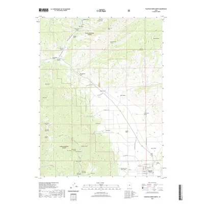
2020 Map of Fountain Green North
USGS Topo · Published 2020About this map
Fountain Green anchors the southeastern corner of this study, positioned where the Sanpete Valley meets the rising elevations of the San Pitch Mountains. The town’s grid, including W Center St and W 400 North St, transitions quickly into the agricultural and wild lands that define the region's geography. To the west, the Uinta National Forest encompasses high-altitude landmarks like Salt Creek Peak and the steep terrain of Holman Canyon.
Find a feature on this map
62 named features on this map. Tap any name to fly to it.
Don’t see what you’re looking for? This feature index may not catch every label — zoom into the map to look around manually.
Map Details
Editions of this 2020 Fountain Green North Map
This is the sole edition of this map. No revisions or reprints were ever made.
Other maps of this area

1885 · Manti
USGS Topo · 1:250,000

1895 · Manti
USGS Topo · 1:250,000

1951 · Moroni
USGS Topo · 1:62,500

1951 · Santaquin
USGS Topo · 1:62,500

1951 · Nephi
USGS Topo · 1:62,500

1952 · Santaquin Peak
USGS Topo · 1:62,500

1956 · Price
USGS Topo · 1:250,000

1960 · Price
USGS Topo · 1:250,000

1962 · Price
USGS Topo · 1:250,000
1979 · Mona
USGS Topo · 1:24,000