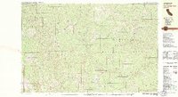
1981 Map of Four Corners Rock
USGS Topo · Published 1982About this map
Six Rivers National Forest and the Mendocino National Forest converge in this high-altitude landscape of the early 1980s, where the Yolla Bolly - Middle Eel Wilderness preserves a network of steep ridges and drainages. The Middle Fork Eel River serves as a primary watercourse, fed by numerous creeks including Yellowjacket Creek and Balm of Gilead Creek. Evidence of local habitation and resource management appears at Travis Ranch, Vann Cabin, and the Indian Dick FS Station. Prominent geological landmarks such as Four Corners Rock, Washington Rock, and Mikes Rock punctuate the ridgelines, while the Blue Jay Mine (Site) indicates the area's history of mineral exploration. The presence of several established campsites, such as Rock Cabin Camp, suggests the area's enduring role as a destination for backcountry travel and forestry operations.
Find a feature on this map
54 named features on this map. Tap any name to fly to it.
Don’t see what you’re looking for? This feature index may not catch every label — zoom into the map to look around manually.
Map Details
Editions of this 1981 Four Corners Rock Map
2 editions found
Other maps of this area

1890 · Red Bluff
USGS Topo · 1:250,000

1894 · Red Bluff
USGS Topo · 1:250,000

1920 · Covelo
USGS Topo · 1:62,500

1921 · Hoaglin
USGS Topo · 1:62,500

1922 · Island Mountain
USGS Topo · 1:62,500

1926 · Covelo
USGS Topo · 1:62,500

1931 · Hoaglin
USGS Topo · 1:96,000

1935 · Hoaglin
USGS Topo · 1:125,000

1952 · Spyrock
USGS Topo · 1:62,500

1952 · Covelo
USGS Topo · 1:62,500