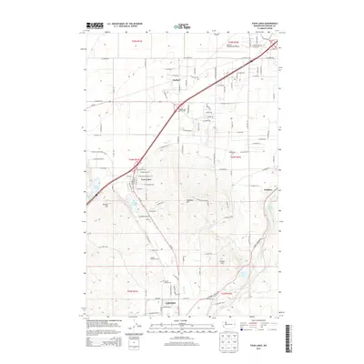
2014 Map of Four Lakes
USGS Topo · Published 2014About this map
Cheney anchors the southern edge of this landscape, where the local road network converges near the Cheney Rodeo Grounds. The area is defined by a series of glacial lakes and prominent rises, including Meadow Lake, Fish Lake, and the heights of Needham Hill and Prosser Hill. This 2014 survey documents the modern infrastructure surrounding the Four Lakes community, showing the complex Medical Lake Interchange and Four Lakes Interchange that facilitate travel through the region. Small settlements like Lakeside and Scribner are nestled among the water bodies, while Marshall Cem and Green Mound Cem offer significant points of interest for genealogists tracing local families. The presence of the Air National Guard facility near the center of the sheet highlights the strategic utility of this terrain, situated just south of the Spokane International Airport.
Find a feature on this map
60 named features on this map. Tap any name to fly to it.
Don’t see what you’re looking for? This feature index may not catch every label — zoom into the map to look around manually.
Map Details
Editions of this 2014 Four Lakes Map
This is the sole edition of this map. No revisions or reprints were ever made.
Other maps of this area

1901 · Spokane
USGS Topo · 1:125,000

1903 · Oakesdale
USGS Topo · 1:125,000

1905 · Oakesdale
USGS Topo · 1:125,000

1943 · Medical Lake
USGS Topo · 1:62,500

1950 · Spokane SW
USGS Topo · 1:24,000

1950 · Spokane NW
USGS Topo · 1:24,000

1950 · Spokane
USGS Topo · 1:62,500

1954 · Airway Heights
USGS Topo · 1:24,000

1954 · Medical Lake
USGS Topo · 1:24,000

1954 · Medical Lake
USGS Topo · 1:62,500