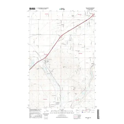
2017 Map of Four Lakes
USGS Topo · Published 2017About this map
The southwest suburbs of the Spokane metro area are defined by a complex network of small lakes and transit hubs in the late 2010s. The northern edge is dominated by the sprawling infrastructure of Spokane International Airport, while the southern portion transitions into the academic and residential reaches of Cheney. Between these points, the settlement of Four Lakes sits near several water bodies including Meadow Lake and Willow Lake. The landscape is punctuated by prominent rises such as Wrights Hill and Needham Hill, which overlook a corridor of highways and rail lines connecting the region's smaller airfields, including Reed Airport and Silverbird Airport. Local history is anchored by the Marshall Cem and Green Mound Cem, preserving the names of early resident families in a landscape increasingly defined by modern transportation logistics.
Find a feature on this map
101 named features on this map. Tap any name to fly to it.
Don’t see what you’re looking for? This feature index may not catch every label — zoom into the map to look around manually.
Map Details
Editions of this 2017 Four Lakes Map
This is the sole edition of this map. No revisions or reprints were ever made.
Other maps of this area

1901 · Spokane
USGS Topo · 1:125,000

1903 · Oakesdale
USGS Topo · 1:125,000

1905 · Oakesdale
USGS Topo · 1:125,000

1943 · Medical Lake
USGS Topo · 1:62,500

1950 · Spokane SW
USGS Topo · 1:24,000

1950 · Spokane NW
USGS Topo · 1:24,000

1950 · Spokane
USGS Topo · 1:62,500

1954 · Airway Heights
USGS Topo · 1:24,000

1954 · Medical Lake
USGS Topo · 1:24,000

1954 · Medical Lake
USGS Topo · 1:62,500