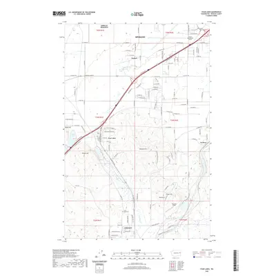
2020 Map of Four Lakes
USGS Topo · Published 2020About this map
Cheney and the northern sprawl of Spokane anchor this 2020 topographic record of the basalt-carved landscape southwest of the city. The area is defined by the transition from urban infrastructure to the unique wetland and lake systems of the channeled scablands, including Spring Lake, Lake Eleanor, and Willow Lake. The map details the convergence of several major transportation corridors, with residential developments pressing against the rail and highway networks that connect the smaller settlements of Four Lakes, Hayford, and Scribner.
Find a feature on this map
65 named features on this map. Tap any name to fly to it.
Don’t see what you’re looking for? This feature index may not catch every label — zoom into the map to look around manually.
Map Details
Editions of this 2020 Four Lakes Map
This is the sole edition of this map. No revisions or reprints were ever made.
Other maps of this area

1901 · Spokane
USGS Topo · 1:125,000

1903 · Oakesdale
USGS Topo · 1:125,000

1905 · Oakesdale
USGS Topo · 1:125,000

1943 · Medical Lake
USGS Topo · 1:62,500

1950 · Spokane SW
USGS Topo · 1:24,000

1950 · Spokane NW
USGS Topo · 1:24,000

1950 · Spokane
USGS Topo · 1:62,500

1954 · Airway Heights
USGS Topo · 1:24,000

1954 · Medical Lake
USGS Topo · 1:24,000

1954 · Medical Lake
USGS Topo · 1:62,500