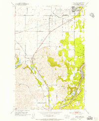
1954 Map of Four Lakes
USGS Topo · Published 1956About this map
Military and municipal aviation define the northern landscape of this Spokane County survey, where the sprawling Fairchild Air Force Base sits adjacent to Geiger Field. The mid-1950s infrastructure reveals a region in transition, anchored by the Northern Pacific Railroad and Great Northern Railroad lines that cut diagonally toward the southwest. Between the military installations and the city of Cheney, small settlements like Four Lakes and Hayford serve as local hubs for the surrounding farm and ranch land.
Find a feature on this map
36 named features on this map. Tap any name to fly to it.
Don’t see what you’re looking for? This feature index may not catch every label — zoom into the map to look around manually.
Map Details
Editions of this 1954 Four Lakes Map
This is the sole edition of this map. No revisions or reprints were ever made.
Other maps of this area

1901 · Spokane
USGS Topo · 1:125,000

1903 · Oakesdale
USGS Topo · 1:125,000

1905 · Oakesdale
USGS Topo · 1:125,000

1943 · Medical Lake
USGS Topo · 1:62,500

1950 · Spokane SW
USGS Topo · 1:24,000

1950 · Spokane NW
USGS Topo · 1:24,000

1950 · Spokane
USGS Topo · 1:62,500

1954 · Airway Heights
USGS Topo · 1:24,000

1954 · Medical Lake
USGS Topo · 1:24,000

1954 · Medical Lake
USGS Topo · 1:62,500