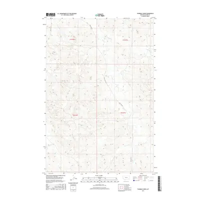
2017 Map of Fourmile Creek
USGS Topo · Published 2017About this map
The Fourmile Cr drainage system carves through this portion of Custer County, defining a landscape of complex coulees and ridges typical of the eastern Montana rangelands. The terrain is marked by a network of intermittent watercourses, including Stony Cr, Elk Cr, and Ranch Cr, which feed into the larger creek systems. Human activity is primarily oriented around the valley floors, where Tongue River Rd and Foster Creek Rd provide the essential transportation corridors through these expansive sections of the Public Land Survey System.
Find a feature on this map
16 named features on this map. Tap any name to fly to it.
Don’t see what you’re looking for? This feature index may not catch every label — zoom into the map to look around manually.
Map Details
Editions of this 2017 Fourmile Creek Map
This is the sole edition of this map. No revisions or reprints were ever made.
Other maps of this area

1953 · Miles City
USGS Topo · 1:250,000

1954 · Hardin
USGS Topo · 1:250,000

1954 · Ekalaka
USGS Topo · 1:250,000

1954 · Forsyth
USGS Topo · 1:250,000

1956 · Ekalaka
USGS Topo · 1:250,000

1957 · Miles City
USGS Topo · 1:250,000

1957 · Hardin
USGS Topo · 1:250,000

1957 · Forsyth
USGS Topo · 1:250,000

1958 · Miles City
USGS Topo · 1:250,000

1958 · Ekalaka
USGS Topo · 1:250,000