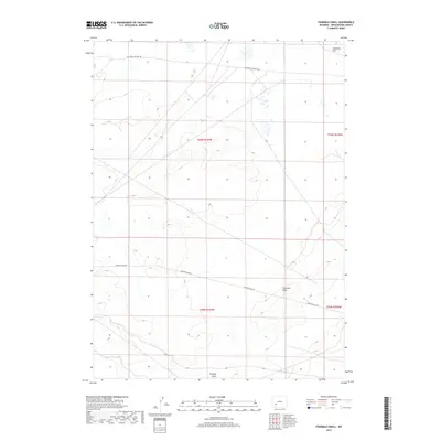
2017 Map of Fourmile Knoll
USGS Topo · Published 2017About this map
The historic California-Oregon Trl cuts across this high-desert terrain in Sweetwater County, tracing a path through the northern portion of the landscape. This area of Wyoming is characterized by sparse, open topography punctuated by landforms like Fourmile Knoll and the low-lying Sublettes Flat. Transport in the region is defined by the intersection of ancestral migration routes and modern access such as Eighteen Mile Rd, which traverses the central sections of the map. In the southern reach, the terrain descends toward Simpson Gulch, reflecting a landscape of seasonal drainage and isolation. The map preserves the spatial relationship between nineteenth-century overland trails and the grid of the Public Land Survey System, showing how these historic corridors persist in the contemporary geography of the American West.
Find a feature on this map
9 named features on this map. Tap any name to fly to it.
Don’t see what you’re looking for? This feature index may not catch every label — zoom into the map to look around manually.
Map Details
Editions of this 2017 Fourmile Knoll Map
This is the sole edition of this map. No revisions or reprints were ever made.
Other maps of this area

1955 · Lander
USGS Topo · 1:250,000

1958 · Lander
USGS Topo · 1:250,000

1961 · Lander
USGS Topo · 1:250,000

1968 · Farson
USGS Topo · 1:24,000

1968 · Twelvemile Knoll
USGS Topo · 1:24,000
1968 · Eden Reservoir West
USGS Topo · 1:24,000
1968 · Simpson Gulch SE
USGS Topo · 1:24,000
1968 · Simpson Gulch SW
USGS Topo · 1:24,000
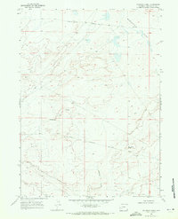
1968 · Fourmile Knoll
USGS Topo · 1:24,000
1969 · Juel Spring
USGS Topo · 1:24,000