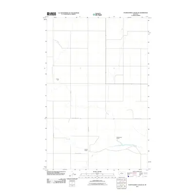
2011 Map of Fourteenmile Coulee SE
USGS Topo · Published 2011About this map
Fourteenmile Coulee and Sixmile Coulee carve through this section of Hill County, Montana, defining a landscape of drainage patterns and dry washes. The area is characterized by large-scale agricultural or ranching plots, where the human footprint is primarily seen in the network of rural roads such as Gardiner Rd N and N Lonesome Lake Rd. Water management is critical in this high-plains environment, as evidenced by landmarks like the M Hass Dam. The map shows a precise grid of property lines and access routes including Edwards Rd and Black Coulee Rd E, reflecting the organized land management typical of the early 21st-century West. While largely devoid of dense settlements, the presence of these named coulees and local infrastructure like Hwy 366 highlights the enduring geographic importance of these drainage systems in the northern Montana landscape.
Find a feature on this map
8 named features on this map. Tap any name to fly to it.
Don’t see what you’re looking for? This feature index may not catch every label — zoom into the map to look around manually.
Map Details
Editions of this 2011 Fourteenmile Coulee SE Map
This is the sole edition of this map. No revisions or reprints were ever made.
Other maps of this area

1904 · Boxelder
USGS Topo · 1:62,500

1906 · Lonesome
USGS Topo · 1:62,500

1906 · Boxelder
USGS Topo · 1:62,500

1919 · Big Sandy
USGS Topo · 1:125,000

1954 · Shelby
USGS Topo · 1:250,000

1958 · Shelby
USGS Topo · 1:250,000

1969 · Box Elder NW
USGS Topo · 1:24,000

1969 · Fourteenmile Coulee SW
USGS Topo · 1:24,000
1969 · Lonesome Lake
USGS Topo · 1:24,000

1969 · Fourteenmile Coulee NW
USGS Topo · 1:24,000