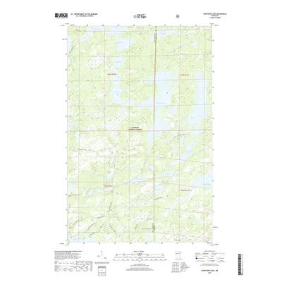
2019 Map of Fourtown Lake
USGS Topo · Published 2019About this map
Superior National Forest encompasses this aquatic landscape along the border of St. Louis and Lake Counties, defined by a dense network of interconnected waterways and portage routes. Central to this wilderness is Fourtown Lake, surrounded by smaller basins such as Boot Lake, Fairy Lake, and Tin Can Mike Lake. The lack of primary roads emphasizes the area's character as a managed natural interior, where travel is dictated by historical winter trails and portage paths. Notable transit markers include the Angleworm Trail in the northwest and the Mudro Access Road, which provides a rare point of vehicular entry. In the southern portion, the T64N Trail Association paths and Range River Winter route illustrate how the landscape is traversed in different seasons. The presence of features like Whisky Jack Lake and the White Hills reflects the traditional naming conventions of this Northwoods region.
Find a feature on this map
35 named features on this map. Tap any name to fly to it.
Don’t see what you’re looking for? This feature index may not catch every label — zoom into the map to look around manually.
Map Details
Editions of this 2019 Fourtown Lake Map
This is the sole edition of this map. No revisions or reprints were ever made.
Other maps of this area

1933 · Ely
USGS Topo · 1:62,500

1939 · Ely
USGS Topo · 1:62,500

1954 · Two Harbors
USGS Topo · 1:250,000

1957 · Two Harbors
USGS Topo · 1:250,000

1957 · Gabbro Lake
USGS Topo · 1:62,500

1957 · Basswood Lake
USGS Topo · 1:62,500

1957 · Quetico
USGS Topo · 1:250,000

1958 · Two Harbors
USGS Topo · 1:250,000

1963 · Fourtown Lake
USGS Topo · 1:24,000
1963 · Angleworm Lake
USGS Topo · 1:24,000